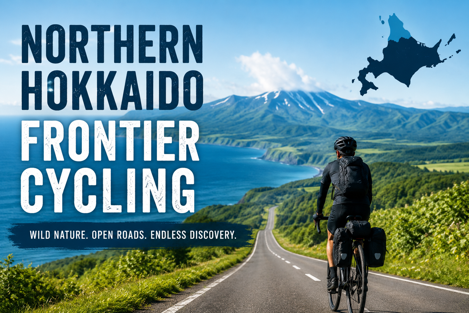
Hokkaido Has Roads Like This
Hokkaido has long, nearly empty roads flanked by impossibly beautiful fields of lavender, sunflowers, and golden wheat — roads where you briefly forget you’re on a bicycle at all and feel like you’re flying.
A two-week cycling route through Hokkaido’s most spectacular scenery — the flower fields of Furano and Biei, the wild cliff-lined coastline of the Shakotan Peninsula, the volcanic calderas of Akan and Mashu, and the wetlands of the Kushiro Lowlands — rivals any two-week cycling route anywhere in the world, offering a true wilderness cycling experience. In a country known for excellent safety, well-developed infrastructure, and a rich food culture, you can spend all day riding roads with almost no traffic, camp at hot-spring campgrounds, eat sea urchin pulled from the Sea of Japan that same morning, and fall asleep under breathtaking, star-filled skies.
This guide covers everything you need for the ultimate two-week cycling adventure in Hokkaido.
Why Choose Hokkaido for a Cycling Adventure?
Most foreign visitors to Japan never leave Honshu — Tokyo, Kyoto, Osaka, and the Shinkansen corridor.
Scale: Hokkaido covers roughly 83,000 square kilometers, about the same size as Austria. The road network is extensive, but outside of Sapporo, traffic is sparse.
Terrain diversity: In two weeks you’ll cycle past volcanic caldera rims, coastal headlands, river valleys, alpine national parks, and wetland plains.
Infrastructure: Japan’s famous convenience stores are widespread even in rural Hokkaido, providing food, ATMs, restrooms, and shelter from the rain — everything you need.
Camping culture: Hokkaido has an excellent network of campgrounds, many attached to hot-spring facilities. Camping is legal and encouraged at designated sites, typically costing ¥500–1,500 per night.
Food: Hokkaido is the heart of Japan’s agriculture and seafood industries. The cuisine here is exceptional.
Route Overview
This two-week loop starts and ends in Sapporo, Hokkaido’s capital. The total distance is approximately 950–1,100 kilometers, taking you through the central highlands, along the Shakotan Peninsula coast, across the eastern volcanic plateau, through the Kushiro wetlands, and back along the Pacific coast.
The route is designed as a clockwise loop to take advantage of prevailing winds during the main cycling seasons of summer and autumn.
Route Overview: 14-Day Itinerary
Getting to Sapporo
New Chitose Airport (CTS) is the main gateway, with direct international flights from Seoul, Shanghai, Taipei, Bangkok, and Hong Kong. From Tokyo, flights run frequently, with a flight time of about 90 minutes.
From New Chitose Airport, the JR Rapid Airport train takes 37 minutes to Sapporo Station. In Sapporo, rental bikes are available at the Sapporo Cycle Station (near Sapporo Station, reservation required) and several outdoor gear shops in the Susukino area.
Day 1: Sapporo to Otaru (60 km) — Coastal Warm-Up
Leaving Sapporo, take the dedicated cycling path along the Ishikari River. This path heads west through the suburbs alongside the river all the way to the coast. When you reach Ishikari Bay, turn north and enjoy Route 231 along the Sea of Japan at a relaxed pace. The road hugs the coastline, with slate-blue sea on your left and gently rolling coastal hills in view.
Otaru, once a thriving port town built on herring fishing and canal trade, still preserves its Meiji-era stone warehouses in remarkably good condition. The Otaru Canal at dusk — gaslight reflected on the water beside amber-lit stone buildings — is one of the most photographed scenes in Japan. The town’s main street is lined with glassblowing studios (Otaru is a center of Japanese glass craft), and local sake breweries and sushi restaurants are well known even outside Hokkaido.
Food: Otaru’s sushi is famous nationwide, with seafood landed that same morning. A seafood rice bowl (kaisendon) topped with fresh Hokkaido sea urchin, salmon roe, and scallops is an absolute must.
Lodging: Otaru has quality business hotels in the ¥8,000–15,000 range. Guesthouses along the canal fill up fast in July and August, so book early.
Day 2: Otaru to Cape Kamui (80 km) — The Shakotan Peninsula
This is one of the most beautiful cycling days in Japan. The Shakotan Peninsula, northwest of Otaru, juts into the Sea of Japan, forming a coastline of sheer basalt cliffs, sea caves, and water so vividly purple-blue it looks digitally enhanced — locally called “Shakotan Blue.”
The road from Otaru follows Route 229 along the coast, climbing and descending repeatedly around headlands. Every time you crest a rise, a new view of blue sea and rocky shoreline opens up. Some stretches are narrow, and the terrain has been reshaped by landslides — a reminder of this peninsula’s raw geological energy.
Cape Kamui, at the tip of the peninsula, is the highlight of the trip. A 2-kilometer trail along a ridge with sea on both sides leads to a lighthouse at the cape’s very tip. It’s best to leave your bike at the parking area and walk. Legend holds that an Ainu woman, rejected by a samurai she loved, threw herself into the sea here — and it’s said the rocks still bear the shape of the word “Kamui,” meaning “god” in the Ainu language.
What to eat: Shakotan sea urchin (both bafun uni and murasaki uni) is landed right here, so fresh it barely seems like seafood — sweet, creamy, and packed with deep ocean flavor. A bowl of Shakotan uni-don at a roadside seafood shop near Bikuni Fishing Port is a once-in-a-lifetime experience; nothing fresher exists.
Day 3: Shakotan to Niseko (75 km) — Mountain Views
Leaving the coast on Route 229, you head inland through the Shiribeshi mountains, where Mt. Yotei takes center stage. Rising 1,898 meters from flat farmland in an almost perfect cone, this stratovolcano is visible for much of the day. Known as “Ezo Fuji” (Ezo being Hokkaido’s old name), Yotei is remarkably symmetrical and dramatic — watching it grow larger through the afternoon as you cycle past potato and corn fields is one of the most memorable experiences on this route.
Over the past 20 years, Niseko has transformed from farming village to one of Asia’s premier ski resorts, driven by investment from Australia, China, and Southeast Asia. International café culture, English-language menus, and upscale lodging make it easy to get around. But it’s worth venturing beyond the resort core into surrounding villages like Kutchan and Mari, which still retain much of Hokkaido’s rustic rural character.
Niseko United Onsen in Hirafudai operates year-round and boasts an open-air bath with a view of Mt. Yotei — a truly special way to soothe tired legs after a day of climbing.
Day 4: Niseko to Lake Toya (70 km) — The Lake
A day defined by water. Heading south from Niseko, Route 230 crosses the Makkari Valley with its sweeping views of Yotei before descending to Lake Toya, a nearly perfectly round caldera lake about 10 kilometers in diameter, with the volcanic island of Nakajima at its center. The road circling the lake is one of Japan’s smoothest, most scenic cycling routes — flat, with little traffic, and lined with cherry blossoms every April.
Mt. Usu, at the lake’s southern edge, last erupted in 2000. Because the eruption is relatively recent, parts of the evacuation zone’s infrastructure remain intact, preserved as the “Volcano Disaster Memorial Park.” Cycling past houses swallowed by volcanic debris and roads destroyed by lava is an eerie, sobering experience. A ropeway to Usu’s crater rim offers sweeping views of the entire caldera, and on clear days, all the way to Hokkaido’s Pacific coast.
Lodging: The hot-spring inns along Lake Toya Onsen represent Hokkaido’s most traditional resort-lodging style. Larger ryokan offer multi-course kaiseki dinners along with full onsen facilities. If your budget allows, treat yourself — an authentic Hokkaido kaiseki meal featuring local crab, corn soup, and dairy-based desserts is a genuine cultural experience.
Day 5: Lake Toya to Noboribetsu (50 km) — Jigokudani
A short day, but don’t underestimate Noboribetsu. Jigokudani (“Hell Valley”), within walking distance of town, is a bubbling, steaming volcanic crater park — one of Japan’s most dramatic geothermal landscapes. The scale of thermal activity is astonishing: orange-tinted fumaroles release sulfurous steam, ash-green boiling mud pools bubble away, and on humid days the intense rotten-egg smell stings your eyes.
The geothermal energy powering Jigokudani also feeds some of Japan’s finest hot springs. Noboribetsu Onsen’s water contains as many as 11 different chemical compositions — sodium chloride, sulfur, aluminum sulfate, and more — each emerging from different strata at different temperatures. Large resort ryokan offer day-use bathing plans, but the town also has small public bathhouses charging ¥400–600, frequented by elderly regulars who’ll likely be pleasantly surprised to see you.
This half-day is an ideal time for bike maintenance, laundry, and restocking supplies before the route’s more remote eastern section begins.
Day 6: Noboribetsu to Lake Shikotsu (90 km)
Heading northeast, the road climbs into Shikotsu-Toya National Park. Lake Shikotsu is a remarkably clear caldera lake, consistently ranked among Japan’s most transparent, with visibility exceeding 20 meters. The road around the lake passes through dense Ezo spruce forest, with the silver gleam of the lake visible between the trees.
Marukoma Onsen, on the lake’s north shore, is accessible only by boat from the main resort area — or by a 20-kilometer gravel forest road, an adventurous option that will wear down road tires. Its open-air bath sits literally at the water’s edge, letting bathers gaze across the still lake at volcanic peaks on the far shore.
Camping option: Shikotsu Campground, in the forest near the lakeside visitor center, offers one of Hokkaido’s most atmospheric camping experiences. ¥550–1,000 per tent site; firewood available for purchase.
Day 7: Lake Shikotsu to Furano (100 km) — The Heartland
This is the route’s central turning point, transitioning from the western lake country to Hokkaido’s agricultural heartland. Route 453 climbs through a forested pass before descending into the Sorachi River valley and the broad plains surrounding Furano.
Furano in July is one of the most photographed landscapes in Asia. Gentle hillsides bloom in stripes of purple and white lavender, yellow achillea, and vivid poppies. The lavender fields at Farm Tomita are an iconic sight drawing hundreds of thousands of visitors, and the fragrance drifting through a warm July afternoon is unforgettable. Beyond July, there’s plenty to see too — sunflower fields in August, snow-dusted harvest scenery in October.
Furano is also known for the cheese, wine, and bread produced by Furano Winery and its partner agricultural cooperatives. For an evening picnic in the lavender fields, pick up local Furano camembert, crackers, and a bottle of local Kerner white wine.
Day 8: Furano to Biei (45 km) — Patchwork Hills
A short distance, but Biei’s countryside is full of scenery that will make you stop again and again. Known as “Patchwork Road” and “Panorama Road,” Biei’s rolling hills are covered in a geometric patchwork of fields planted with crops that shift color through the seasons — vivid green in June, gold and purple in July, tawny brown in October. Distinctively shaped trees dotting the fields — the “Tree of Philosopher,” the “Seven Stars Tree,” the “Ken and Mary Tree” (named after a 1970s car advertisement) — have become landmarks in their own right.
Cycling in Biei is less about covering distance and more about paying attention to your surroundings. Bring more food and water than you think you’ll need, ride slowly, and take every interesting side road you see. Biei’s best views are often found not at the famous viewpoints, but about 500 meters down an unpaved farm track.
Biei town itself is surprisingly developed for a village of 10,000, with several excellent restaurants, a good bakery, and a bike repair shop — and, above all, the beautiful Shirogane Blue Pond. This accidental reservoir glows in a milky, otherworldly turquoise thanks to aluminum hydroxide from a nearby hot spring. It’s a 12-kilometer round trip from the town center, but well worth the pedaling.
Day 9: Biei to Sounkyo (55 km) — Gateway to Daisetsuzan
The Daisetsuzan mountain range is the heart of Hokkaido’s alpine country, a cluster of volcanoes centered on Daisetsuzan National Park, Japan’s largest national park at 226,764 hectares. Sounkyo Gorge, running through the park’s eastern edge, features 24 kilometers of 150-meter basalt cliffs lining both banks of the Ishikari River, with Ryusei Falls (“Shooting Star Falls”) and Ginga Falls (“Milky Way Falls”) cascading down the cliff faces.
The climb from Kamikawa to Sounkyo gains 450 meters over 30 kilometers on paved, lightly trafficked roads — a gentle gradient. The gorge narrows gradually, with cliffs growing taller as you head upstream, eventually reaching a small hot-spring resort town at the gorge’s source.
The Sounkyo Ropeway climbs to Mt. Kurodake (1,984 m), where the summit offers sweeping views of Hokkaido’s volcanic highlands in every direction. This is true alpine terrain — snow can linger until June, fog can roll in year-round, and despite being just 200 meters from the ropeway station, it feels remarkably remote and otherworldly.
Lodging: Sounkyo Onsen village has several hot-spring inns. Meals center on Hokkaido mountain fare — river fish, wild vegetables, and rich mountain-vegetable soups. Large ryokan have open-air baths overlooking the gorge’s cliffs; bathing under moonlight with the cliffs in view is unforgettable.
Day 10: Sounkyo to Lake Akan (120 km) — The Long Ride East
The longest day on the route, but the crossing from the Daisetsuzan highlands to the eastern volcanic plateau is mostly flat or gently downhill. Route 39 heads east from Sounkyo through Kitami, the world’s largest producer of peppermint, and on into the broad Abashiri Plain.
The final stretch to Lake Akan re-enters volcanic terrain — ash-gray hills, steam rising from roadside fumaroles, and the smell of sulfur in the air. Lake Akan is known for two things: a significant population of Ainu, Hokkaido’s indigenous people, and marimo, a unique species of spherical algae. Marimo form perfectly round, velvety green algae balls up to 30 centimeters in diameter, found growing wild in only a handful of lakes worldwide.
Ainu Kotan village, on the shore of Lake Akan, is Japan’s largest Ainu settlement, with authentic cultural performances, craft workshops, and restaurants serving traditional Ainu dishes — ohaw (salmon and root vegetable soup), sep ohaw (salmon stock), and pochimo (millet dumplings). This is living culture, not a museum exhibit.
Day 11: Lake Akan to Lake Mashu (50 km) — Mysterious Waters
If Hokkaido has one view that leaves you speechless, it’s Lake Mashu. This 355-meter-elevation caldera lake is ringed by 200-meter vertical caldera walls, with fog constantly drifting in over the crater rim. Mashu has no inflowing or outflowing rivers — it’s filled purely by rainwater and has no drainage — giving it clarity second only to Lake Shikotsu among Japanese lakes, and an atmosphere of deep, hushed stillness unlike any other lake in the country.
On clear days, the lake glows an unbelievably vivid cobalt blue, so deep it seems to absorb light rather than reflect it. Local legend holds that young people who see Mashu clearly will never marry — but since the lake is so often shrouded in mist, most locals no longer worry about the superstition.
The road climbing 350 meters from the valley to the caldera rim leads to some of Hokkaido’s finest scenery — take your time to enjoy it. The view from the second observation deck, looking east across the lake to the volcanic peak of Mt. Io, will stay with you for years.
Between Akan and Mashu, the route passes Mt. Io (“Sulfur Mountain”), an active fumarole field where vents are thickly coated in yellow sulfur crystals, with steam rising from the ground even in summer. You can cycle to within a few meters of active vents — a rare place in the world to witness this kind of geological activity at ground level.
Day 12: Lake Mashu to Kushiro (70 km) — The Wetlands
Descending from Mashu brings you to the Kushiro Wetlands, one of Japan’s most distinctive ecosystems. Covering 18,290 hectares, it’s Japan’s largest wetland and a designated Ramsar site. Rather than the dramatic scenery of volcanic calderas, this is a flat, tranquil, sweeping expanse of marsh. Reed beds stretch in every direction, and the call of the red-crowned crane — one of Japan’s iconic birds and among the rarest cranes in the world — echoes across the wetland.
A dedicated cycling path along the wetland’s edge offers views you’d never see from the road: vast marsh skies, herons standing motionless in the reeds, the distant call of sika deer from willow thickets. In October and November, hundreds of cranes gather at specific feeding grounds — head out at dawn and you may see them in flight up close. With a 2.4-meter wingspan and a red crown, they’re unmistakable even from a distance.
Kushiro is a working fishing port, and its charming waterfront, known as Fisherman’s Wharf MOO, sells Pacific salmon, cod, and saury as fresh as you’ll find anywhere. The city’s izakaya serve Hokkaido seafood at remarkably reasonable prices — this isn’t a tourist town, it’s a fishing town, and the prices reflect that.
Day 13: Kushiro to Cape Erimo (100 km) — The Wild Pacific
Heading west from Kushiro along the Pacific coast, Route 38 enters the Hidaka region — one of Hokkaido’s least populated and most untouched coastlines. Cliffs face the open Pacific with nothing to block the Kuroshio and Oyashio currents colliding offshore, producing fog and swells and a rugged ocean energy quite different from the calm Sea of Japan coast.
Cape Erimo, Hokkaido’s southernmost point, is a narrow granite-and-basalt peninsula jutting into the Pacific, known for some of the strongest gusts of wind in Japan. The famous folk song “Erimo Misaki” by Morio Kagiyama captures the desolate, majestic stillness of the relentless wind here. On clear days, spotted seals can be seen sunning themselves on rocks offshore — bring binoculars.
The visitor center at Cape Erimo has an exhibit called “House of Wind,” where you can stand in a wind tunnel that recreates the strongest gusts ever recorded at the cape, to experience its meteorological character firsthand.
Day 14: Cape Erimo to Sapporo (130 km, or by train)
The final day offers two options depending on your stamina and schedule. Riders with energy to spare can head north on Route 235 along the Hidaka coast, then inland through the Yufutsu Plain — Japan’s flattest and most prominent horse-breeding region, dotted with hundreds of thoroughbred farms — before reaching Sapporo via the New Chitose Airport Expressway. The Hidaka coast is spectacular in afternoon light, and the sense of accomplishment after covering over 1,000 kilometers under your own power is something special.
If you’re pressed for flight time, you can take the JR Hidaka Main Line north from Tomakomai to Sapporo (about 2 hours, bikes accepted in a rinko bag). You’ll arrive with time to enjoy a seafood dinner at Nijo Market before your flight home.
Either way, Susukino in Sapporo — the largest entertainment district north of Tokyo — offers every kind of celebratory meal, from legendary Sapporo ramen (miso-based, with butter and corn) to Hokkaido crab dishes, plus whisky bars stocked with Hokkaido’s own Nikka whisky and single malts from northern Japan’s distilleries.
Practical Information
Best Season
June: Wildflowers on volcanic slopes, long daylight hours (sunset after 7:30 pm), fewer crowds ahead of peak season. Some passes may still have snow in early June.
July: Peak bloom for lavender in Furano and Biei. The most popular month, so book accommodation early. Temperatures range 20–28°C on the plains, 10–18°C at elevation. Long daylight, generally clear skies.
August: Still warm, with sunflower fields replacing lavender. Typhoon risk increases late in the month, so watch forecasts. The Pacific coast is popular with Japanese families on summer holiday, and accommodation fills quickly.
September–October: Arguably the best cycling season. Crowds thin dramatically, autumn colors begin mid-September at higher elevations and mid-October at lower elevations, temperatures are ideal (15–22°C), and it’s harvest season, so food is at its peak. Cranes return to the Kushiro wetlands. Highly recommended.
Avoid: November–April. Snow and ice make much of the route impassable, and many campgrounds and seasonal facilities close from November through April.
Bike Recommendations
Hokkaido’s roads are generally in good condition, but the route includes some rough prefectural-road sections and an optional gravel detour (the Shikotsu forest road). A touring bike with 32–40mm tires is ideal. A gravel bike also works well and expands your options on unpaved sections. Skip narrow-tired road bikes — they’ll manage, but riders will struggle on rougher stretches and unpaved shortcuts.
Essential gear for Hokkaido:
- Bear bell: Brown bears (higuma) live throughout Hokkaido, especially in the east and at higher elevations. A bell on your handlebars alerts bears to your presence — a startled bear is a dangerous one. Available at convenience stores and outdoor shops across Hokkaido.
- Rain gear: Weather changes quickly along the Sea of Japan coast and the eastern volcanic plateau. Always carry a packable waterproof jacket and pants.
- Lights: Long summer daylight hours make late-evening riding common. A strong headlight and taillight are essential for mountain descents after dark.
- Warm layers: Even in July, mountain areas (Sounkyo, Mashu, Biei) can drop to 8–12°C at night. Bring a mid-weight fleece.
- Sunscreen and eye protection: UV exposure in Hokkaido’s lowlands is stronger than it feels, and the cool air is deceptive.
Lodging Options
Camping (best for atmosphere and budget): Hokkaido has an excellent network of campgrounds within national parks and near hot-spring towns. Most charge ¥500–1,500 per tent site. Camping beside a caldera lake or in a riverside cedar grove, with access to a nearby onsen, is one of the great pleasures of cycling in Hokkaido. Pick up a “Hokkaido Camping Guidebook” at a Sapporo bookstore before you set off — it lists facilities, access, and GPS coordinates for every campground.
Rider houses: Hokkaido has a unique style of lodging developed for motorcycle and bicycle tourers called “rider houses.” These are basically bunk-bed dormitories costing ¥500–1,500 per night; cyclists are welcome. Facilities are minimal (futon or basic bedding, shared kitchen, shared bathroom), but the camaraderie with fellow travelers is excellent. The rider house network is most active in eastern Hokkaido, around Akan and Kushiro.
Minshuku and business hotels: Available in every town. Minshuku (family-run inns, ¥5,000–8,000 with meals) offer the most authentic local experience; business hotels (¥7,000–12,000) offer more consistent facilities and, in some cases, better bike storage.
Onsen ryokan: Worth splurging on in areas with deep hot-spring resort culture, like Lake Toya and Noboribetsu. Budget ¥15,000–30,000 per night for a proper ryokan with a full course meal.
Budget
| Lodging style | Cost per night | Meals included? |
|---|---|---|
| Camping | ¥500–1,500 | No (self-catering) |
| Rider house | ¥500–1,500 | No |
| Minshuku | ¥5,500–8,000 | Usually dinner + breakfast |
| Business hotel | ¥7,000–12,000 | Breakfast optional |
| Onsen ryokan | ¥15,000–30,000 | Usually dinner + breakfast |
A comfortable two-week budget mixing camping, rider houses, and the occasional minshuku runs about ¥7,000–10,000 per day. Add ¥2,000–3,000 per day if combining minshuku and business hotels. Add another ¥8,000–20,000 for nights at an onsen ryokan.
Bear Safety
Hokkaido’s Ezo brown bears (higuma) are large (males up to 250 kg) and found across the island, occasionally causing serious accidents. A few simple precautions apply when cycling through their habitat:
- Attach a bear bell to your handlebars and keep it ringing at all times. Bears almost always flee from noise. Most bicycle-bear encounters are harmless, as the bear notices you approaching and leaves.
- Avoid riding through forested areas at dawn or dusk, when bear activity peaks.
- Never approach, feed, or attempt close-up photos of a bear. If you see one on the road, stop, make noise, and wait for it to leave.
- At campgrounds, use the provided food storage boxes (bear-proof bins) and never keep food in your tent. Hang food bags on the bear-proof hooks provided.
- Carry bear spray in eastern Hokkaido (Akan, Kushiro, Shiretoko areas), available at outdoor shops in Sapporo and Kushiro. Learn how to use it beforehand, just in case.
Bear caution is not a reason to avoid Hokkaido. Thousands of cyclists complete this route every year without incident. It’s simply part of cycling through genuine wilderness — and adds to the sense of real adventure.
Convenience Store Strategy
In Hokkaido, convenience stores (konbini) are essential to daily life. Get to know the three major chains — Lawson, 7-Eleven, and FamilyMart. In remote parts of Hokkaido, these three chains are often the only grocery option within a 30–50 kilometer radius. They offer:
- Hot food (onigiri, fried chicken, soba, curry) available 24 hours
- Seasonal Hokkaido specialties that rotate with the harvest (corn soup, Hokkaido soft-serve, melon bread)
- ATM access (7-Eleven ATMs are the most reliable for international cards)
- Basic bike tools at larger stores (zip ties, pump adapters, etc.)
- Shelter from rain, and a place to sit and eat
Hokkaido’s soft-serve ice cream deserves special mention. Each region has its own flavor — lavender in Furano, melon in Yubari, corn in Obihiro, milk in Betsukai — and touring the island’s soft-serve varieties is practically its own sub-hobby of a cycling trip.
Hokkaido Food Guide: Eating Your Way Across the Island
Hokkaido is Japan’s pantry. Covering 22% of the country’s land area, the island produces 25% of Japan’s agricultural output, and its quality is exceptional thanks to long, harsh winters, volcanic soil, and pure water. Cycling through Hokkaido means passing through the places Japanese chefs travel the country to source ingredients from.
Seafood
Sea urchin (uni): The Shakotan Peninsula and Sea of Japan coast produce some of Japan’s finest sea urchin. Look for bafun uni (orange, richly sweet) and murasaki uni (paler, more delicate). Best eaten at the source — a uni-don in Shakotan or Otaru for ¥2,000–4,000 is incomparable to the same dish at triple the price in Tokyo.
Hokkaido crab: The three main varieties are kegani (hairy crab, available year-round, sweet and delicate), tarabagani (king crab, enormous legs, best simply boiled), and zuwaigani (snow crab, a winter specialty). Best enjoyed at Sapporo’s Nijo Market or seafood restaurants in Kushiro.
Salmon roe (ikura): Hokkaido salmon run upriver in September and October. Ikura cured in salt and sake is uniquely fresh and rich. In autumn, order a sake-ikura don — for ¥1,500–2,500, it’s an unforgettable dish.
Scallops (hotate): The Sea of Japan and Funka Bay produce large, sweet scallops, eaten raw as sashimi, grilled in the shell with soy sauce and butter, or dried as a base for dashi stock.
Dairy and Agriculture
Hokkaido milk and butter: Rich and creamy, distinctly different from milk elsewhere in Japan. Try fresh bottled milk at farm stands — well worth the detour by bike.
Yubari melon: The world’s most expensive melon; a top-grade Yubari melon has sold at auction for ¥3 million. More affordable melons from roadside stands in the Sorachi region run ¥1,500–3,000 and are rich, sweet, and fragrant. Don’t hesitate to eat half of one during a cycling break.
Jaga-bata (potato with butter): Hokkaido potatoes topped with Hokkaido butter, sold at food stalls across the island. A classic Hokkaido cycling soul food, ¥300–500, best eaten standing by the road.
Furano wine and cheese: Furano Winery produces crisp, robust white wines from Kerner and Gewürztraminer grapes reminiscent of Alpine styles. The Furano Cheese Cooperative makes excellent camembert, gouda, and blue cheese. Together, they make a perfect hillside picnic spread.
Ramen
Hokkaido has three famous ramen towns, each with its own distinct style:
- Sapporo ramen: Miso-based broth with thick, curly noodles, topped with butter, corn, and sometimes bean sprouts. Rich, warming, and quintessentially Hokkaido.
- Hakodate ramen: A light, clear shio (salt) broth — unusual for Hokkaido and delicately flavored. Thinner noodles and simple toppings, often chashu pork and nori.
- Asahikawa ramen: A double-broth style blending pork bone and seafood stock with soy sauce tare, topped with a layer of oil to keep the soup hot through Hokkaido’s winters. The richest of the three.
Wildlife Along the Route
One unexpected joy of cycling in Hokkaido is the wildlife. The island’s low population density and largely intact ecosystems mean frequent encounters with animals rarely seen elsewhere in Japan.
- Ezo sika deer: Large deer with impressive antlers, found across the island, grazing roadside at dawn and dusk. Populations have surged in recent years due to predator decline and climate change, and they show little fear of cyclists — evening rides often involve weaving through small herds on rural roads.
- Red-crowned crane (tancho): One of the world’s rarest birds and a symbol of Hokkaido wildlife. Resident year-round in the Kushiro wetlands, gathering in flocks of hundreds in winter. Often seen flying low over the marsh at dawn.
- Spotted seal: Comes ashore on rocks near Cape Erimo and the Nemuro coast. Most visible from January to June, though some remain at Erimo year-round.
- Ezo red fox: Hokkaido’s native red fox, somewhat larger and more thickly furred than its Honshu relatives. Commonly seen roadside, and has learned that cyclists carry food. Admire from a distance — never feed them, as it fosters dependency and can make them dangerous.
- Ezo brown bear: Found island-wide, most often spotted near streams or berry patches in late summer. Most encounters are brief and harmless — bears leave once they see or hear you. See the bear safety section above.
Getting There, Getting Around, Getting Home
International Access
New Chitose Airport (CTS) is the main gateway, with direct international flights from Seoul (1h50m), Taipei (3h), Shanghai (3h30m), Hong Kong (4h), and Bangkok (6h30m). From Europe or North America, connections via Tokyo (Narita/Haneda) to CTS are easy — the Tokyo–Chitose route is one of Japan’s busiest domestic routes, with dozens of daily flights.
Bringing a Bike
Japan’s major airlines (ANA, JAL) and most international carriers accept bikes as checked baggage. Fees typically run ¥1,000–3,000 domestically, and are usually included within baggage allowances internationally (varies significantly by airline). It’s recommended to partially disassemble your bike (removing pedals and handlebars, deflating tires) and use a hard case or padded soft case. Bike shops in Sapporo — particularly Y’s Road Sapporo and Sapporo Cycle Station — offer rental, repair, and short-term storage for those wanting to rent a bike on arrival.
JR Hokkaido Rail + Bike
JR Hokkaido allows bikes packed in a rinko bag (a compression-style bike bag) on all trains. This makes it easy to skip sections, avoid bad weather, or return to Sapporo quickly from any point on the route. Rinko bags can be bought at bike shops and some sporting goods stores in Sapporo for ¥3,000–8,000. Learning to pack one efficiently (removing wheels, wrapping the drivetrain, etc.) takes about 30 minutes the first time and around 10 minutes after that.
Finally: What Makes Hokkaido Special?
Cycling in Japan often means experiencing a paradox: a country renowned for order that is also, surprisingly, deeply wild. Hokkaido resolves that paradox beautifully by holding both at once. The infrastructure is orderly — the roads are excellent, the convenience stores are reliable, the hot springs are warm and always available — while the scenery, climate, wildlife, and sheer scale remain genuinely untamed.
Some days in Hokkaido, nothing will go as planned. Fog may roll into Lake Mashu and hide everything from view. Fierce winds off Cape Erimo may push your bike backward even on flat ground. A deer may leap from the roadside grass while you’re doing 50 km/h, and it will genuinely startle you. Rain may fall all day along the Sea of Japan coast, leaving you eating a soggy rice ball in a convenience-store doorway in soaked clothes, watching passing trucks’ wipers and wondering exactly what you’re doing out here.
And then the fog lifts, or the rain stops, or the deer glances back at you with total indifference and trots off into the trees, and a straight road opens up ahead with mountains in the distance and the scent of lavender drifting in from the fields. In that moment, you’ll know exactly why you’re here.
Bring your bear bell. Take your time through the lavender fields. Eat the sea urchin.
Quick Reference
| Detail | Information |
|---|---|
| Total distance | Approx. 950–1,100 km |
| Start/end point | Sapporo (New Chitose Airport) |
| Daily distance | 45–130 km |
| Best season | June–October (peak: July, September) |
| Recommended bike | Touring or gravel, 32–40mm tires |
| Daily budget (mixed lodging) | ¥7,000–12,000 (approx. $45–80) |
| Wildlife hazard | Brown bears (use a bell; risk is low) |
| Language difficulty | Intermediate (basic Japanese useful outside cities) |
| Physical difficulty | Moderate (manageable climbs, long flat stretches) |
| Best food experiences | Shakotan sea urchin, Kushiro seafood, Furano lavender soft-serve, Sapporo miso ramen |